A tale of hurt on the Great North Walk – 29 Sept – 02 Oct 2015
By Anabatic
The challenge of completing a non-stop run or hike of 260km of the Great North Walk between Newcastle and Sydney had been tempting me for some time. Having walked it six years ago over 10 days and last year completing the GNW100km race in under 20hrs, I was ready for another goal. I am not a strong runner but after reading the account of Meredith Quinlan and Jess Baker who in 2012 made a record time of 54 hrs 54 minutes, I really became keen to give it a crack. I imagined I might make it in around 80 hrs unassisted.
My first attempt was on Easter weekend 2015. I set off with rain forecast but no knowledge of the low pressure system and trough about to combine and create the havoc that eventuated. I spent a torrid but thankfully dry first night under my tarp in torrential rain at Barraba Trig and was picked up at the Congewai Valley track head the next morning. The tracks had become treacherous with the relentless rain and there was no way I would get past Watagan Creek. I was disappointed but glad to get out of there.
After that episode I decided to wait till spring to try again, figuring a full moon around September to be the next best opportunity for me. Meanwhile in July, Joe Ward from Manly Beach Running Club ran it fully supported in an incredible 49hrs 5 min. I dropped in on him and his pacer on the morning of his first day and briefly ran with them down from Strzelecki and along Bar Beach. I was really keen to give it another crack. Finally, having lost my job due to company closure and with the prospect of a new job starting, I made the decision to take this window.
The following is my account of how my second attempt went for me. My apologies if it is a bit long but I hope there is something in it for anyone wanting to do this great trek, be it in 50hrs or 15 days.
GPS tracking link: https://www.google.com/maps/d/edit mid=zP8EcvswJYaA.kln_O-wRuTPo&usp=sharing
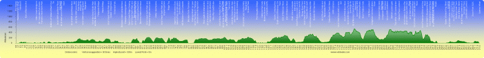
(Credit to Matt McClelland of wildwalks.com for GNW Sydney to Newcastle terrain profile image)
Day 1 – Queens Warf to Barraba Trig Campsite – 66km
I was already awake when the 3:45am alarm went on my phone. Switching it off, I got up and changed into my running gear which I had laid out in the lounge room. I rubbed hand cream on my feet before putting on my socks and also applied pawpaw ointment to my body anywhere I thought might chafe.
Breakfast was a good bowl of microwaved porridge with golden syrup. I was 4 weeks into a high protein diet and along with three boot camp sessions a week had shed 10 kg off my stubborn 92kg normal. Carbohydrates in the form of oats, bread and rice had been strictly off limits but there was no way I was going to fuel this trip on just protein.
I had hurriedly packed the evening before and I did a last minute check to ensure I had phone, credit card, cash, lights and batteries in my pack before going out the door. I drove into Newcastle and parked the car up on Ordinance St by the Obelisk where it is free parking. There, I geared up with my pack and bum bag and walked down the hill to Queen’s Warf. It was very pleasant with a full moon and pre-dawn glow over the ocean.
At the Queen’s Warf track head I took a couple of selfies with my phone  and started the Followmee Tracking App. My progress could be tracked online at home by Leah and she also would send a link to the tracking map to any others interested. With all seemingly working, I set off bang on 5am, striding out across the walk bridge, pausing to take another shot of Venus in the eastern twilight before putting my phone into its breast pouch. Letting my pack and gear settle in, I broke into a light shuffle along the mall and turned and strode up the hill on Bolton St.
At the top of the hill I took a couple of photographs from the Obelisk and had a drink from the water tap on the fence. I had a 3ltr bladder in my pack and to save weight I only had 1ltr of water in for this leg. I planned to take water from bubblers and taps as I needed it along the beaches and suburbs, only filling up when I got to Heaton’s Gap servo.
After the Obelisk, I broke into a light shuffle. I wanted to make the most of the roads and footpaths on the first day to get as many free km behind me while I was fresh. I took the route along the new Anzac walkway and took in the view over the city with the full moon setting toward the Watagans in the west. I was feeling relaxed and comfortable.
Stopping to take a shot of the sunrise from the promenade at Dixon Park, I then detoured down the stairs onto the beach to say hi to Sarge Shepherd and Corpl Kovacs from Original Bootcamp Merewether, https://www.facebook.com/merewether.bootcamp/’ who were grinding a large group of recruits on the sand. They had no idea what I was talking
about as I went past, telling them I was on my way to Sydney. I owe it to those guys for getting me in shape and giving me the physical confidence I needed to do what I was doing. The morning before was the monthly Boot camp benchmark tests and I had shaved good times off my benchmarks despite a slight injury.
I left them behind and shuffled along Merewether Beach and around the rocky point then along Burwood Beach. The tide was low enough and I found good packed sand there which made the going easier. The rocky point at Glenrock however had suffered a lot of sand erosion and I only just managed to pick my way past the surf, having to climb on the coal seam shelf at the base of the cliff.
The single track up through Glenrock went easy though I had to climb through a tree that had fallen on one of the walk bridges. It seemed no time at all before I was crossing the Pacific Highway at Charlestown. Keeping up the same light steady shuffle when the track suited I passed the ugly illegal rubbish dumps in the bush behind Charlestown and crossed under the Newcastle bypass road, following the track past the golf course and finally out onto the back streets of Warner’s Bay around 08:00am.
Text messages of support had started to come in now as people opened their emails and the links to my tracker. It was great encouragement though I found it hard to manage messages while trying to concentrate on the track. I never really got good at it at all and it became quite a time intrusion.
At Warner’s bay I stopped at a hot bread shop and bought two fresh cheese breads and a Gatorade. After swapping my beany for my legionaries cap, I stashed one cheese bread in my pack and ate the other as I made my way around the lake. When I finished I continued shuffling along at 8km hr feeling very relaxed and well.
I nearly stopped at the coffee shop by the footpath at Teralba but kept going thinking instead of the Heaton’s Gap servo. The road after Teralba along Wakefield slipped by uneventfully though it was getting hot. I stopped at the small memorial park building on the side of the road and filled my empty Gatorade bottle with fresh water from the rainwater tank, soaking my cap with the cool water as well. Leaving Wakefield Road I was reduced to a long stride and made the M1 underpass at 10:30am. I was quite pleased with my progress so far.
The long climb up Sugarloaf ridge at Awaba was as relentless as I 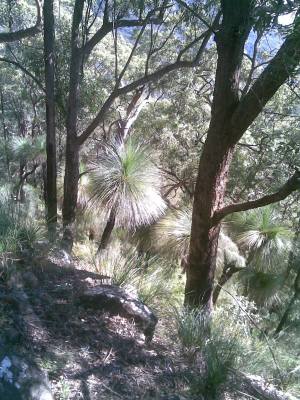 remembered, though not as hot as I expected. The fire trail continues to be marked either side with warning tape to prevent anyone leaving the trail as mine subsidence has been a disaster up there. I found it pleasant passing among the tall grass trees on the narrow ridge top with a nice breeze from the south blowing across the track. The descent down to Heaton’s gap was steep and skatey as usual. I arrived at the Servo at 12:05. It had taken me 7hrs to cover the first 44km – 6.3km/hr average. That would change.
Heaton’s gap was my first staging post. I went straight into the store and bought three cold 1.5ltr bottles of water, a can of solo, a small bottle of lift, a spring roll, battered sausage, potato chips, fruit cake and also sun-cream, which I had omitted to pack. Retreating to the shaded table in the rest area, I emptied what remained of the tepid water in my bladder and filled it to the top with 3ltrs of bottled water. I drank down the can of solo while eating the battered sausage. Believe me it was good. The chips, cake and spring roll I stashed in the outer mesh pockets of my pack with the bottle of lift as well.
I put sun cream on my arms, neck and face and then turned my attention to my feet. I removed my shoes and took off my socks, shaking them out well. I had left my gaiters on the couch at home which meant I would be having to continuously contend with debris and sand in my shoes. I applied cream again to my feet and shook out my shoes well before putting them back on. I was determined to look after my feet because if I let them get in bad condition I wouldn’t be finishing.
Carrying the third bottle of water in my hands I set off across the road and started the steep 300m ascent up the bluffs to the tower. I expected it to  be hot going in the midday sun and it was. After the euphoria of getting to the servo, this climb slowed me right down and took my spirit with it. I remembered feeling the same way climbing here in the hot sun when competing in the GNW100 last year. Usually, when training, this was the beginning of the run and done early in the day. Now, with 44km under my legs and carrying extra water and food, I was not sprightly at all. After what seemed like 45min I was at the lookout sucking in the cool breeze and I felt a whole lot better as I shuffled along the gentle forest road section from the tower to the beginning of the rainforest track at Heaton’s lookout.
The rainforest track as I often hear it referred to, is for me one of the more relentless sections of the GNW. Deserved or not, I never look forward to, or enjoy this section of track. Generally it is damp with slippery roots and rocks and loaded with leaches, not to mention at least three creek gullies to contend with. The track is normally very hard to define in places and without the red and pink paint markers on trees, it would be very easy to lose your way. On a normal training run, starting at Heaton’s gap with minimal weight to carry, I can get through this 7km or so section from Heaton’s Lookout to Maclean’s Lookout in under 1.5hrs. When I made my previous attempt at Easter, in flogging rain and with 12kg of water, food and gear, I slipped, grovelled and climbed for over 3.5 hrs and came out seething with leeches!
This time was nowhere near that bad. Despite a week of rain on the coast 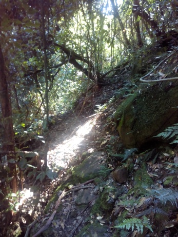 the forest and track were quite dry and as I had hoped, the GNW100 race two weeks prior had defined the track quite well. I was now carrying around 10.5kg and wasn’t that nimble at all, but I was pleased to get through it in around 2hrs 10min, arriving at Maclean’s lookout just after 4:00pm. I didn’t see any leaches at all.
About 30min in, I came across a young European guy going the other way. He was tired and was intending to camp at Heaton’s and hoped to finish the whole thing the next day. He said this was day 14 and wished he could swap his 18kg pack for mine. I told him he was nearly through the worst and we wished each other luck.
It was a shame to see just how may huge eucalyptus trees had been brought down in this area by the storms. In particular, at the start of the 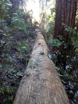 long straight climb up out of the bluff gully creek, hikers now have to climb over the trunk of a massive stringy bark with a girth diameter of at least 1m, and maybe a 20m straight trunk.
Celebrating reaching MacLean’s lookout with a muesli bar, soy crisps and about my 4th salt tablet for the day, I strode out along Bakers Road and stopped to fill my now empty water bottle from the water tank at Hunter Lookout. I put an Aqua tab in for good measure even though the water wasn’t tasting or looking that bad at all. Carrying the 3ltrs in my bladder seemed a bit pointless, but I just know if I didn’t have it, the tank would be empty!
With around 15km of forest road and fire trail to Barraba, I figured I should make it by dark at around 6:30pm. Whenever I am on a trail and I see distances, I always compare them to known benchmarks in my head and use that to gauge what I have ahead and how long it should take me. Of course, these benchmarks do not account for fatigue and heavy packs so I always set myself up for disappointment.
It seemed to take me forever. I was mostly down to a max pace of around 5 km/hr and by the time I had to stop and gear up for night hiking at 6:00pm, I was still more than 1hr away from Barraba. Not that I knew that. I sent a few texts home including photos of an echidna I saw on the side of the  road and the sun setting over the Hunter Valley. Sarge Shepherd was also letting me know my progress was being watched with a text every now and then either telling me I was smashing it or wanting to know why I was sitting down as my GPS speed was 0km/hr. Hooyah Sarge! I had another muesli bar which hit the spot and continued on, arriving finally at Barraba camp site at 7:30pm and was thrilled when I looked east and saw a most awesome blood red full moon!
I hadn’t been sure if I would camp at Barraba or push through to Flat Rock Camp on the other side of the Congewai Valley. Arriving at Barraba, I saw no point in carrying on. Barraba is a milestone marker for me for a couple of reasons. For one, it marks the end of the Watagans before the decent into Congewai. Also and particularly, it is one of the most pleasant camping spots on the GNW with its grassed areas and numerous tall Grass trees. There has been a new water tank and catchment roof added here since last year’s GNW100 which at least offers a small roof to shelter under in the wet though the floor is hard stony gravel.
I decided to set up here for a 4hr break. I laid my hoochie tarp out by the tank and unpacked my pack onto it. The first order was to tend to my feet. I took off my shoes and washed my feet and thoroughly dried them. I had a plaster on the ball of my right foot where I had lost a thick callous due to a pressure blister some weeks ago, but it had come off during the day and I hadn’t felt any hot spot there at all so I didn’t replace it. I put plenty of hand cream all over my feet and put a fresh pair of merino hiking socks on. I stripped and changed out of my hiking clothes and put fresh underwear on also, after first applying pawpaw ointment again to potential chafing areas. So far no chafing or blisters. I then put on long thermals pants and top, light fleece, and light water proofs. I felt really good.
Arranging leaves and branches as best I could under my tarp along with clothing and pack to act as cushioning on top, I had created at least some comfort to lie on. I filled my water bottle with water from the tank which tasted a little strong and added an Aqua tab. As I was filling my bottle, I found myself staring down a neatly lined hole in the ground, face to face with a big black funnel web spider. I couldn’t cope with the thought of this brute crawling around while I slept so I placed an appropriately sized stick into the funnel entrance. Sorry about that mate!
Sitting on my tarp against the water tank, I ate my spring roll and washed it down with water and some of the soft drink. I had a few potato chips as well while I checked my gear and connected my phone to one of the battery banks for charging. It started to rain just as I settled down to sleep with my tarp folded over me.
I slept well, stirring now and then to stretch my twitching legs before finally looking at my watch to see it was midnight – time to get up.
Day 2 – Barraba Trig Campsite – Somersby School – 77km
Changing back into my hiking clothes, I put my dry sleeping clothes into my dry bag and placed my used socks and underwear into a separate plastic bag. I shook out and folded up my tarp and packed everything into my pack. Putting on my beanie and headlamp, I mounted my pack and bum bag and did a walk around to make sure I hadn’t left anything. Last thing I did was pull the stick out of the funnel web spider’s hole. I didn’t wait around to see if he was coming out.
I set off about 00:20am along the track past the old logger’s hut eating an apple and feeling very good. My feet and legs felt like new. The rain had gone and it felt quite mild.
It took around an hour to get to the valley floor from Barraba, descending the steep and quite technical track down the side of the ridge. My LED headlamps lit up the track and surrounds brilliantly even when on the lowest setting to conserve battery. I noticed the temperature begin to drop sharply as I walked down through the trees on the flanking foot hills to Congewai Road. I was glad for my beanie and fleece.
I sat on the top of the fence style at the track head and dug out my bag of soy crisps. I snacked on them as I strode out along the valley road with my lights off, able to see perfectly under the full moon. It was very cool and pleasant going. The road was in the best condition I had seen. It must have been graded recently and had just enough traffic to smooth the surface without creating wheel tracks or loose stones.
At around 02:30am I arrived at the track head leading to the start of the climb out of the Congewai Valley and up the western ridge topped by the iconic coms tower. I was relieved that the usual cattle huddled on the farm road were not there, not so much because I was scared of them, but I didn’t want to stir them up and start the farm dogs barking. As it turned out, I managed to slip by without creating any fuss.
I had to turn my lights back on as I started along the foothill track. Not looking forward to this climb I had an energy Gel and resolved to take it steady. It took me about 1.5 hrs from the track head, scrambling up the steep and rough final climb to arrive at the tower feeling not too bad. It 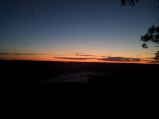 was good to finally be able to start heading south toward Sydney at last. I opened a muesli bar and set off along the ridge top on Lagan’s Road, stopping to take a predawn photo from Flat Rock lookout of Congewai Valley with a heavy blanket of mist.
I filled up my water bottle again at the Flat Rock camp water tank and continued on, finally able to turn off my headlamp before heading down the steep single track into the Watagan Creek valley. I crossed the foot bridge over the creek and walked along the fence line, followed closely by a cheeky herd of yearling steers up to Watagan Creek road. Over the road, I stopped at the camp area for a break. By now it was 06:30am.
I ate the remaining cheese bread for breakfast with the last of my soft drink then took my shoes off again, cleaning my feet and shaking out my socks before putting them back on again. Then I headed up the very steep 4WD track feeling pretty good, though it seemed to take forever to get to the narrow ridge camp spot just past Mt Warrawalong, another of my favourite milestones on this walk. It took me 4.5 hrs to cover the 18.5km from Watagan creek to Cedar Brush track head, which was very slow going considering so much of it was fire trail, although the gully tracks were steep and rough. I saw plenty of wildlife along this section. Black and grey kangaroos and huge goannas’ that would claw up the nearest tree when I came across them. The dry branches in the hot sun on the side of the forest roads would often rustle as I walked past and twice I got a glimpse of red belly black snakes making off into the bush. I arrived at the Yarramalong Valley road track head around 11:30am on what had become a very hot day.
In the shade at the track head, I again tended to my feet and ate fruit cake which went down well. I was dreading the walk along the valley in the heat but had no choice but to keep going. I put on sun cream and soaked my legionaries cap with water and set off, keeping to the shade of trees lining the road. The 11km from cedar Brush track head to Yarramalong should have taken less than two hours but it took me at least two and a half. I coped with the heat from the sun and the hot tarmac well enough but I had become very tired and began falling asleep as I was walking, staggering like a drunk at times. Finally I arrived at the Yarramalong store at around 02:15pm.
I ordered a hamburger and chips and bought the usual fresh water and soft drinks, then went around the back of the store and sat at one of the outdoor tables and set about changing socks and replacing the water in my bladder. I really enjoyed my hamburger and ate half the hot chips as well, stashing the rest in my pack mesh pocket for later. When I finished eating and sorting my gear, I laid back on the bench and had a welcome 10 minute snooze only to awaken to find the sky had become overcast and gusty winds had started.
I quickly geared up and set off up Brumble Hill at 03:00pm, feeling surprisingly well recharged and energetic. My legs and feet felt fine and hardly noticed the incline. Before I got to the top of the hill, the rumbling thunderstorm hit with heavy rain. I put the cover over my pack and initially tried to keep myself dry with my useless light rain jacket before taking it off and allowing myself to become drenched. I figured now I would have to keep moving until I got to Somersby.
I put my beanie and head lamps on under a power pylon just before descending into the thick rainforest gully after Cherry Lane road. It quickly got dark once I got in there but I made a good pace through the rough gully despite I was barely able to recognise the track. I felt very energetic. That hamburger and half hour rest had worked wonders.
It was still raining heavy as I started heading down a fire trail that seemed to go down forever before turning into an even steeper single track, down, down before finally reaching the creek at stringy bark point. Crossing the creek I pressed on at a smooth pace along what I considered an unpleasant and spooky creek side trail. Finally I could see some lights ahead which turned out to be reflections from road markers and the trail eventually turned into Ourimbah Creek road and I found myself passing the rural properties of Hidden valley. From memory, very pretty during the day, but somehow ominous and spooky in the cold, damp fog. I continued on the road until reaching the track head to Palm Grove where I stopped and rested for a bit. Making a phone call home to say goodnight and check in, I ate some cold chips before heading up the trail.
After a couple of climbs and descents into gullies, and a change of headlamp battery, I finally came up and onto Kilkenny Road at around 10:30pm. My thoughts were now on somewhere dry to sleep and I considered an old pump house on the side of the road but kept on going, imagining I could find something at Somersby.
Nearing the end of Kilkenny road, I heard a car making a horrific mechanical thumping sound turn onto Dog trap road and coast toward Kilkenny road. Not really wanting to be seen alone on this lonely road by anyone remotely undesirable, I stepped well off the road and into the shrubbery. To my dismay, the vehicle which had a totally wrecked tyre flopping around on its front rim, pulled up right next to me. One occupant got out and started swearing and I just walked off. I don’t think he even saw me from the glare of his own headlights.
Finally, I walked into Somersby through a light drizzle and fog. The Store was lit up like a Christmas tree so I couldn’t settle down there. I was being given a lesson on how it must feel to be homeless. I crossed the road and 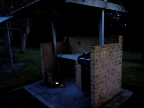 into the school grounds where I found an outdoor BBQ shelter and settled down there, spreading out my tarp and changing into my dry warm thermals and waterproofs after first completing my foot tending ritual and change of underwear. I was very pleased to still have no sign of blisters or hotspots or chafing so far. My feet were coping very well, though I was going to lose a couple of toenails due to cramming on the downhills.
I plugged my phone into a battery bank, ate a muesli bar and some snakes and then, wrapped in my tarp, huddled down to sleep on top of what little cushioning I could create from my pack and clothes. It was nearly midnight, I had been on the go for almost 24hrs.
Sleep was very uncomfortable due to the hard cold concrete floor. I ended up sleeping standing up, wrapped in my tarp, with my upper body slumped over the bench and my head in my arms. I actually slept well that way, stirring occasionally to change leg positions.
Day 3 – Somersby School to Cowan Station – 55km
I woke before daybreak and began packing up my gear and changing back into my hiking clothes. I intended to have a good breakfast at the store when it opened, but wanted to be out of the school grounds before it got light. My phone didn’t appear to have charged much, so assuming the battery bank was flat, I plugged in the second one. As I was changing a car turned into the school car park and parked about 30m from where I was. I was sprung. I continued what I was doing as the driver got out of the car and stood looking at me briefly before walking toward the School entrance and disappearing from view. He re-emerged a short while later from the side of the school building across the playground from me and walked over holding some straps in his hand.
As it turned out he was doing maintenance and painting at the school. We had a chat and I told him what I was up to and he offered me to use the toilets and take water if I needed. He then excused himself and set up the bands on the monkey bars and started to do some pull ups. I finished packing and filled up my water bladder, then headed out the gate.
Crossing the road, I walked over to the store and was disappointed to read a sign on the door indicating new opening hours. The store wasn’t going to open for another 2 hrs at 07:30am. I milled around a bit wondering what to do. A young female runner came along the road, saying hi as she passed. She stopped at the top of the slight hill and ran back down to turn around and sprint back up. I mused at how everyone I met so far was into their fitness.
I decided I could not spend the time waiting for the store to open, so I did a mental stock of what food I had on me and decided to push on to Patonga. I ate the remaining cold chips and soy crisps for breakfast as I left Somersby and turned onto Sylvester’s road. I had two muesli bars, two tubes of vanilla and banana custard, a zip lock bag of snakes, and glucose tablets to last me to Patonga. The time was a little after 06:00am.
I took a selfie with my phone and sent it in a good morning text home. I  had my phone and battery bank in a small dry bag now attached to my breast strap. The phone kept beeping, telling me it was going on and off charge. I fussed around with it as I walked along and found that the charging cable plug was not securely plugging into the phone. I couldn’t seem to fix it and didn’t want to do more damage by forcing it so I put away the charging bank and trusted the battery would see me through to the end. The tracking app itself doesn’t use that much battery as it is set to take GPS or tower triangulation every 15 min and then send the data via 3G. If there is no 3G signal, it will cache the data until the phone comes in range again. Generally battery drain is mostly due to the phone searching for a 3G signal when coverage is sporadic.
While I was doing that, I decided to remove the screen lock password, which was a pain to enter every time I received a message, especially when out in the sun as it was hard to see the screen.
I felt fresh and progress was easy going down through Robinson Creek gully, along past the sand quarry and water tanks, and as I followed the rough track descent down past the dam before crossing Mooney Mooney creek. The long trail alongside the creek was quite pleasant and I could gradually hear the sound of traffic on the M1 Bridge getting nearer. Not long before the locked vehicle access gate where Karool road meets the forest road, I waved to a NSW Parks & Wildlife ranger heading up the track in his 4WD. Reaching the gate I was really disappointed to find a freshly burnt out SUV still smouldering. I really hate the way our bush is used as a trashing yard.
I reached the Pacific Highway Bridge around 10:00am. The day was fine and for now I was enjoying the warm sun. The track head said 22km to Patonga. Not far I thought. I still had not learnt my lesson about distance.
I went well along the flat single track by the tidal creek taking about 20 minutes to reach 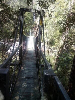 the swing bridge at Piles Creek. Crossing to the other side, I came across a gang of four NSW Parks & Wildlife guys armed with saws, pruners and tools for track maintenance. We spoke briefly and when I told them I was heading to Patonga they asked if I had enough water and if I had anyone expecting me. I assured them I did and I headed up the track out of the gully on what was to become a long hot day.
Getting up onto the plateau sections of Brisbane Waters National Park, the scale of the distance I had to cover was revealed. The imposing peaks of LeoCharles and Mt Kariong where prominent on the horizon but looked miles away in the heat haze and I knew passing them was just the start. I slogged on in the heat feeling quite lethargic now. I still had plenty of water and was regularly sipping on my bladder and having the odd snake and glucose tablet for energy, though they didn’t seem to make much difference. A muesli bar followed by a tube of Vanilla custard helped a fair bit but my progress still seemed agonisingly slow.
Despite its harshness I did appreciate the plateau terrain and its 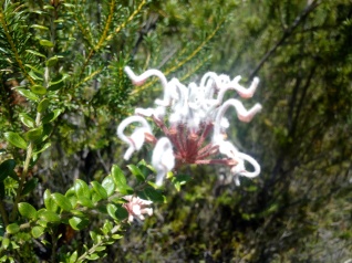 pockmarked rock flats with an almost moonscape appearance. It always seems to be putting on a display of colourful flowering shrubs here and I took several photos of the different coloured flowers. Unfortunately the wild orchids weren’t blooming. I have somewhere a photo taken years ago of a brilliant yellow orchid flower growing from under a rock here on one of my earlier GNW hikes
 The heat and my slow progress was getting me short tempered. I discovered that when I had removed the password from my phone screen lock, I had failed to activate any screen lock at all and my phone had been up to all sorts of mischief when stashed away in its breast pouch, making pocket texts and changing settings including re-setting the time to NZ standard time 3 hrs ahead! I was cranky and swearing as I changed the time back to AEST and activated a swipe screen lock.
Finally I reached the Wondabyne Station / Patonga track Junction around 12:30. There was a group of teenage walkers with a couple of adults eating and resting in the shade. I was shattered when I read the track head sign saying Patonga 15km. Shit I had only come 7km from the Pacific highway. I looked at the group and lamented “The end doesn’t seem to get any closer does it!” They responded in agreement as I headed for Patonga.
Next I realised that the damp sweaty feeling on my lower back was actually my water bladder leaking. Furious now, I took off my pack and eased the bladder out. Fortunately it was only minor leaking caused by the clip – in tube fitting, somehow getting unclipped and the o ring joint becoming loose. It would have been a lot worse if it had completely disconnected! I put it all back together and carried on.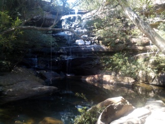 Soon after a couple of text messages came in. One was from my brother in law Baz, informing me my tracking had dropped off since the M1 and the time was not showing correctly. Too cranky to explain by text I got him to call me and I explained what had happened. I said I would reset the tracking app and asked him if he could let me know if that fixed it. I stopped and re-started the tracker and he soon sent me a text saying I was back.
An hour later I was grinding my way in the full sun up the rocky track toward the base of Mt Wondabyne. The air was completely still and even felt hot to breathe. The bush around me was not big enough to provide any shade and it was so dry I felt it would ignite on its own. I was familiar with this area as I used to mountain bike here years ago and I could still pick out the lines we would take down the technical tracks. Mt Wondabyne is visible for miles and while only 250m ASL, I actually witnessed it sleeting up here once. I was with three others and we were doing a walk from Patonga to Staples Lookout. It was snowing in the Blue Mountains at the time and what started as a sunny day, suddenly became very dark and blue to the west. We got hit by a bitter front from the SW and as we raced toward the mountain for shelter, the horizontal rain became slushy ice. Amazing.
After rounding the mountain the track lead down to the junction at Dillon’s track, easier going but I was just plodding in the heat. I was really grateful for the job my legionaries cap was doing protecting me from the sun. A text came in from Sarge Shepherd encouraging me and reminding me to keep hydrated. I appreciated that and let him know I was. I decided to stop at the junction and take a rest in some shade. I ate the last muesli bar and the tube of banana custard taking plenty of water as well. I didn’t stop long as I just wanted for it to be over. Getting going again, I felt the first sign of the sea breeze kicking in.
In my original plan I had asked for Leah and Aubrey to pick me up at Patonga around midday. Earlier, I had sent a text message revising that time to 03:00pm, then again now to 05:00pm. I was beginning to think about how easy it would be to call it quits at Patonga, but I would snap out of that when I realised I would only be back to try again and I just didn’t want to do this again. Besides, yes I was tired and lethargic and frustratingly slow, but I was not injured or in any pain from blisters or chafing. Aside from injury I should finish, so just keep going.
By 03:30pm I had come down past the Woy Woy tip and was on Van Dahls fire trail. Easier going but never ending drudgery walking into the afternoon sun. A kilometre or so before I got to the main Patonga road, I saw ahead of me on the left an open flat rock area where I noticed a figure crouching, digging at the rock with a stick. As I got closer, I realised the guy had no pants on. Initially I guessed he was taking a crap but when he realised I was coming he jumped up and ran around startled before picking up his shorts and running away holding his shorts behind him. I just kept walking as if I saw nothing. When I got to the main road and I crossed to the track on other side, there was a white car parked with two men sitting inside who watched me the whole time. It got even weirder when the car started and slowly idled along seemingly following me as I walked along the track in the trees parallel to the road. I made a point of staring back and reached for my phone in my breast pouch. They sped off as I got it out.
The view from the lookout was stunning but short lived. The track from the lookout down to Patonga was very difficult, as I couldn’t step downhill well at all now which was becoming a problem. The late afternoon had become quite pleasant and the water was looking very inviting as I came down the track. At one stage during planning I had considered leaving my kayak at Patonga so I could cross the Hawksbury under my own steam, but didn’t think it wise in the end. Turns out it would have been a perfect paddle to Brooklyn this afternoon.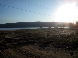
Finally, almost bang on 05:00pm, I arrived at Patonga Beach. Frustratingly my phone camera wouldn’t take a photograph at the iconic GNW marker as its memory was full. I didn’t have the energy to fight with it. Walking across the road I was disappointed to see the shop had just closed. My ride hadn’t arrived yet, so I went to the pavilion next door and unloaded my pack onto a table and set about my routine. I washed my feet under the tap and drank its cool fresh water and refilled my bladder. Then I started to thoroughly wash my used socks as I had put my last fresh pair on this morning. I lashed two pair to the outside of my pack so they could dry. By this time Leah and Aubrey had arrived and she went into the pub to order a hamburger and chips while Aubrey told me everything he had been doing.
When Leah returned with my hamburger we climbed into the Subaru and left Patonga around 06:00pm, stopping at a servo on the way to buy soft drink, muesli bars, snickers etc. I really enjoyed my hamburger though didn’t eat many of the chips. I appreciated being able to rest but only had a couple of light dozes. My legs couldn’t get comfortable and seemed to twitch, ache and itch at the same time. It took around an hour to get to Brooklyn and I got out of the car at the Warf and set off up the road to the track head, saying goodbye and leaving Leah and Aubrey at the Anglers Rest Pub where they were going to have dinner before continuing to Sydney. It was around 07:00pm and I felt a bit warm and over dressed in my beanie and fleece as I climbed the stairs and track to the fire trail above Brooklyn. My day wasn’t over yet, I had to get to Cowan at least tonight.
The road around the dam and up the ridge on the 4WD rail maintenance track was uneventful though seemed to go on forever. At the beginning of the climb after the dam, the road has been tar sealed for a short distance which was new to me and made the initial steep climb a little easier. Generally the trail was quite easy but I was tired mentally and physically and I started to nod off as I was walking, allowing myself slightly longer micro sleeps each time, actually veering off into the bushes once. That’s where a no doze tablet would be great if I had remembered to buy some.
At a bit after 09:00pm I arrived at the track head where the single track leaves the 4WD trail and heads down to Jerusalem Bay. The distance from Brooklyn to Cowan is 11km and it had taken me a little over 2 hrs to cover the first 6km which was by far the easiest part of the trail. The track down to Jerusalem Bay was very rough going. Much of it is climbing and clambering down massive sandstone rock faces and boulders so high that steel hand holds are grouted into the rock. This was extremely slow going for me in my state. My legs seemed to have no agility to step down while supporting my body weight and I had to sit and lower myself using my arms more and more. I was tired and would often pause and doze briefly when I sat on a boulder top before lowering myself down. At this stage I took to mumbling and singing out loud to myself in some attempt to stay conscious.
Finally, I reached the bottom of the final steep ridge and rounded a goat track onto the rest area at Jerusalem Bay. I was relieved to finally be able to stride out on a half decent forest trail again. The climb up the creek gulley trail to Cowan was much easier and I felt much more energetic going uphill. It didn’t seem like long at all before I was crossing the access bridge across the M1, with my thoughts now on where I was going to sleep. I briefly considered sleeping on the bridge, then by the transformer station at the other side, before continuing over the tracks and onto the Cowan Station platform at around 11:45pm, where I looked for a water supply. Finding the water fountain not working, I was about to leave when my attention focussed on a little waiting room with one wooden bench seat. The room was all lit up and dry and warm so I sat and dozed there for a while, enjoying the sleep that much that I decided to take my shoes off and lie down and get more comfortable.
I slept there to the sound of diesel freight trains roaring past, subconsciously waking whenever a train pulled up at the station, sometimes hearing voices but seeing no one pass the door except for one old guy, who looked like he was going to come in but was startled when he saw me and walked on. The poor bugger was probably homeless and I had taken his spot. I must have looked pretty rough, I certainly would be smelling pretty bad.
Day 4 – Cowan Station to Woolwich Warf – 63km
Despite the noise and interruptions, the sleep was just what my body and mind needed and after about two and a half hours I felt I had rested enough. I sat up and put my shoes back on and walked off the platform to cross the Pacific Highway to the track head on the other side. Here I paused to look at the GNW sign with remaining distances as I ate a large carob muesli bar which went down really well. I set off toward Berowra Waters around 02:45am feeling comfortable and in a positive mood. It was 8km to Berowra Waters and I hoped to be there by daylight.
The first part of the track made easy going, mostly flat trail and track and in 30 min I was at the bench seat at the valley lookout. I briefly stopped here and took off my fleece and beanie as it was very mild. The track then took its sharp rough descent down into Joe Crafts Creek gorge and despite feeling a lot more agile now it still was slow going. Dawn found me as I was making my way down the final steep descent to Berowra Waters. The view of Berowra Waters was impressive as usual and I could hear the sound of a single outboard motor from a small boat making its way to the ferry head.
I arrived at the track head at 05:45am and took a drink of fresh water from the tap at the top of the track head stairs and started the climb up the Benowie Track, stopping for quick breaks and looking back at the spectacular view of the water and waterside settlement bellow. The tranquillity of the scene was by now being continuously broken by the sound of commercial aircraft on their low approaches from the north into Sydney Airport. It made me think of the many times I had been on overnight flights from Hong Kong, coming in to land after having had breakfast as the sun rose over the red interior.
After about an hour I was on the Berkeley fire trail where the going was easy and mostly ![11001940_835455166526620_8015162805956615454_n[1] (2)](https://anabatic.net/wp-content/uploads/2016/01/11001940_835455166526620_8015162805956615454_n1-2.jpg?w=278&h=320) flat and I passed Naa Badu lookout with one of my favourite views down over the upper reaches of Berowra toward Crosslands. The GNW south of the Hawksbury River has always impressed me. You can be feeling lost in such remote and wild scenes, yet Sydney suburbia is only shouting distance away through the bush.
flat and I passed Naa Badu lookout with one of my favourite views down over the upper reaches of Berowra toward Crosslands. The GNW south of the Hawksbury River has always impressed me. You can be feeling lost in such remote and wild scenes, yet Sydney suburbia is only shouting distance away through the bush.
My thoughts were now on the tide as I would soon be having to cross Calna Creek and last time I was on the track 10 months ago, the bridge was collapsed. If the tide was low enough, the creek could be waded across, but high tide required a swim. I had forgotten to bring a plastic rubbish bag which I was going to use to float my pack and gear across. As I was mulling this over I got a good morning text and then call from Baz who had checked on my position. He told me he was sure the bridge had been replaced though he had not seen it yet.
Leaving the fire trail and heading down the steep single track to Sam’s creek, I came across another hiker coming up the track looking strong and fresh. We stopped briefly and chatted, His name was Bert and he was on his way to Newcastle, raising money for Lyme’s disease awareness. He said he had spent the night at Crosslands and thought he might take four to five days to get to Newcastle.
![20121001093336_650d_00344[1] (2)](https://anabatic.net/wp-content/uploads/2016/01/20121001093336_650d_003441-2.jpg?w=304&h=332) I wished him luck and carried on down to the creek and made my way along the water side track eventually crossing the boardwalk over the impressive reed flats, another of my favourite places on the walk. I was relieved to find there was indeed a new bridge, crossing it at 07:45am and arriving at Crosslands camping grounds 20 minutes later. I stopped at the southern end of the grassed park and took my pack off at a picnic table area. I changed out and replaced the water in my bladder with fresh water from a tap and ate a muesli and snickers bar, enjoying the warmth of the morning sun. After shaking the grit and debris out of my shoes and socks, I put my pack and legionaries cap on and at 08:30am headed off toward Galston Gorge.
I wished him luck and carried on down to the creek and made my way along the water side track eventually crossing the boardwalk over the impressive reed flats, another of my favourite places on the walk. I was relieved to find there was indeed a new bridge, crossing it at 07:45am and arriving at Crosslands camping grounds 20 minutes later. I stopped at the southern end of the grassed park and took my pack off at a picnic table area. I changed out and replaced the water in my bladder with fresh water from a tap and ate a muesli and snickers bar, enjoying the warmth of the morning sun. After shaking the grit and debris out of my shoes and socks, I put my pack and legionaries cap on and at 08:30am headed off toward Galston Gorge.
The 7km track to Galston Gorge starts off easy as it follows the tidal reaches of Berowra 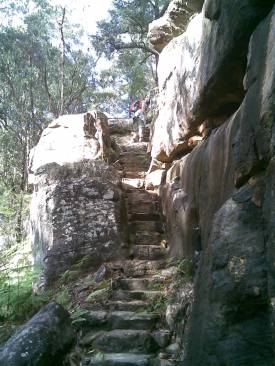 Creek before picking its way up the sides of the gorge at varying elevations. I was getting along at a slow but reasonably consistent pace, taking water in regular sips. The long set of steps created between a couple of large sandstone boulders being the most memorable part for me other than it was starting to get pretty hot. I could hear the traffic crossing the bridge at the gorge before I came down some steps to the track head and rest area in the shade by the Galston Gorge bridge. The time was 10:25am. It had taken 2 hrs to cover 7km. With 42km still to go I wouldn’t be at Martin Place by 7pm for a beer with Baz like I’d suggested when we spoke at 6am!
Pausing long enough to eat a couple of snakes and to judge the timing between the flow of cars coming down the gorge, I ran across the bridge and climbed the impressive rock formation on the other side, using the steel handholds and railing where provided. In only 10 minutes I was on the fire trail at the top where it was relatively flat and shaded and I managed to shuffle 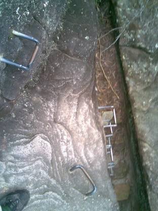 for the first time since I don’t know how long. It was easy going for about 15 minutes, before turning downhill and into the sun at the Tunks Ridge camp site.
Here the fire trail descends sharply and is actually concreted in the steepest parts. With my legs failing yesterday and last night on the down hills, I wasn’t looking forward to this however I found I could descend easiest by doing a short rolling heel toe shuffle.
On my way down, I started to see everywhere brown paper bags broken on the road with white powdery contents spilled out. I laughed to myself as I remembered my nephew Thomas telling me of one of his Cadet camps where they were out in groups in the night, stalking and ambushing each other using flour bombs. I figured that was what had gone on here though I wouldn’t have had a clue otherwise.
I continued down this way, concentrating on the ground in front of me and looked up briefly to see a couple of young backpackers standing in the shade on a bend watching me doing my very odd looking waddle. A bit embarrassed I said “I’m sure this looks as weird as it feels! They grinned and asked how far I had come. They were pretty impressed actually and said they’d love to do the whole GNW but they were heading to Galston Gorge today. They even offered me iced water but I gratefully declined. As I started to move on the young guy pointed at some of the busted flour bombs. “We were just trying to figure out these things” He said in an Irish accent. “Looks like there has been an aerial drug drop gone wrong or something. What do you reckon?”
When I got down to Steele Bridge at 11:40am there were even more flour bombs and sitting on the edge of the bridge with a huge pack on the ground was a young German guy boiling up some 2 minute noodles. He said he was going to Crosslands. He didn’t mention the flour bombs all over the bridge around him.
The 10km of single track from here follows Berowra Creek up to its source at Thornleigh and is normally a stimulating section of trail for me with interesting features and cool rock formations and creek crossings. All the time I was being tempted by the many perfect looking swimming holes and the water looked so inviting in the relentless heat. I passed some teenage boys enjoying one swimming hole and again thought how lucky people in this part of the city were to have such a beautiful place to get lost and cool off, just down from suburbia. I was really starting to slow down now and I kept going wondering just when this trail would end. I couldn’t recognise much of it as I hadn’t travelled it in this direction before. The creek got less and less as the trail followed the narrowing catchment and I was expecting the end around each corner.
Finally the track came up on to a fire trail and I knew I was close. Then I was walking along a creek next to someone’s back yard and finally came out on to a suburban street and drearily slogged my way in the sun up the back streets before arriving across from Thornleigh Station. Turning the corner I went straight to the takeaway shop. Two customers were being served before me and I dared not enter the shop as I knew I must really smell bad by now. I waited for them to leave then went in and grabbing a can of solo, I ordered a burger and chips from the busy Chinese lady who greeted me with an understanding look and smile. While waiting for my order, I went across the road and over the tracks to pick up a fresh pair of socks Leah had stashed at the walk bridge over Pennant Hills Road.
Returning to pick up my burger and buying another can of solo, I crossed the road to the grassed area under the trees by the GNW sign. I set my tarp down on the grass next to a large rock there and sitting on it I took my shoes off and cleaned my feet and put on hand cream. My feet were tired and a bit sore but thankfully still no blisters. Putting the fresh socks on, I then leant back against the rock and ate my burger and chips which went down so well. The whole time traffic was stopping at the lights on what was becoming a busy Friday afternoon. Drivers and passengers would look at me while stopped but then look away to avoid eye contact. Pedestrians pouring out of the train station passed right by me but never looked at me. I must have looked rough and I felt once more I was getting a lesson on what it was like to be a homeless person. I was invisible to the world it seemed. I don’t blame them, I am exactly the same when I walk past the destitute, looking ahead, too ashamed to make eye contact.
Finishing my burger I settled down for a much needed doze in the dappled shade for what seemed like 10 minutes but was probably an hour. It was so comfortable. Lying there, I started thinking about the remaining 32km when I suddenly realised just how low the afternoon sun was. I should have been on my way already if I was going to make the last ferry at Woolwich Warf at midnight. Putting my shoes on and rolling my tarp back into my pack I set off over the train station and then the Pennant Hills Road pedestrian bridge, before realising I hadn’t stocked up with water. I went straight into the Aldi store on the other side of the bridge and bought a snickers bar and two 1.5 ltr bottles of water and filled my water bladder outside on the footpath. I also set up for the night run, putting my long sleeve thermal on under my running shirt and then putting my head lamps on as well before setting off down the street. By now it was after 05:00pm. I had spent two hours on this break and if I was going to catch that ferry I had to average nearly 5km/hr.
As before at Yarramalong, the burger and chips with rest had done wonders and my body had recovered really well. This combined with the sudden urgency of the ferry cut off time, seemed to give me a whole lot more energy and focus and I jogged the back streets past the recreational area and then down the track to the Lane Cove Creek trail. The road along the creek bed is roughly surfaced with round stones the size of baseballs or larger and aside from being uncomfortable require a lot of concentration to avoid a rolled ankle. Even so, it seemed the excitement of the renewed urgency had me effortlessly gliding along at a light jog. I came across a couple of hikers coming the other way with big packs. They were very tired and slow. They said this was their first day of the GNW heading to Newcastle and were finding the going hard. Then I started to come across the occasional runner coming the other way looking fit and fast. Seemed this track was well used as an after work training run. The rough fire trail improved and I came across mountain bikers as well. One had a set of LED lights like mine blazing away as he approached and realising light was fading fast I switched mine on also, making sure they were on the lowest setting to conserve battery.
I felt good and seemed to be able to move effortlessly. I couldn’t feel the pack on my back and I was bounding up hills and flights of steps on the single track without breathing hard or even raising my heartbeat. It was a new and almost serene sensation. I just kept following the track, taking note of signs and markers and occasionally checking my map when needed to confirm my position. With night navigation in the bush, there is only the sphere around you the size of the distance your lights can reach. Prominent landmarks and geographical features outside that sphere are not available for reference as in daylight which makes navigation by map alone very challenging. I was using my instinct, observing footprints and trusting the trail signs and markers to be in the right places. Sometimes the single tracks would split and if there was no marker I would have to make my best choice. I kept going in a trance as swiftly as I could and I felt that so long as I could keep this pace up and didn’t get lost I had a good chance of making that ferry.
At the trail junction with Kissing Point Road, I received a text from Leah saying I was going awesome and had progressed a lot further than expected. I replied saying I had to keep it up otherwise I would miss the Ferry and what would I do then? She text back and said she’d check the Ferry timetable. She did and it turned out the last Ferry to Circular Quay from Woolwich was 11:15pm! 45 minutes less than I thought! That put even more emphasis on my pace now! The time was now 09:00pm and I had 20km to cover in the next four and a quarter hours. Though I wasn’t sure of the exact distance at the time, I knew I couldn’t let up.
Then my rhythm came undone at a track junction when I thought I should be nearing the Lane Cove weir. The GNW sign at the junction had both tracks posted. One said Fidden’s Warf the other something loop track. Neither meant anything to me or showed on my map. Both tracks were equally well used. I took the loop track that seemed to continue parallel to the water course on my right that I had been following. As I bounded along I couldn’t help stressing over what ‘Loop track” meant. Was this going to take me on a loop back to the same spot? I couldn’t afford to keep going not knowing if it was the wrong direction or not. After 5 minutes I stopped and again looked at my map which seemed useless. I turned and ran back to the junction. I decided it was phone a friend time. I called Baz who by now was at home in Epping. He did well to decipher what I was rambling about and after checking my last GPS position managed to convince me I was not as close to the weir as I thought and while he wasn’t sure what the track head was, I shouldn’t take the Fidden’s Warf option. So, I set off back the way I had previously taken, frustrated at myself for wasting 15 minutes or more.
Still pushing well I finally made the Lane Cove River Park at 08:45pm and after walking over the weir I ate my snickers bar before crossing the busy Delhi Road and climbed up the rocks to join Quebec road. I shuffled past the cemetery and down the street until turning back onto single track along the right hand side of the tidal reaches of the Lane Cove River. Not long after, I passed under, then up onto and across the Epping Road Bridge, then crossed the river again over the service pipe foot bridge above the Ingredion factory. I was at Magdala Park and it was now 21:30. I had one and three quarter hours to complete the remaining 11km. I was averaging just over 5km/hr till now and I would have to pick it up if I was to make that ferry!
I still felt strong and was amazed at how my body continued to keep going so well despite the 250km behind me. I wasn’t exactly running but I was jogging when the track allowed and when it didn’t I was skimming along the top of the rough stuff at least. Well I thought I was anyway. The air was damp and cold but felt good to breathe and I still didn’t feel any shortness of breath or raised heart rate when bounding uphill. After the track and boardwalks through the mangroves I finally made it to the end of Boronia Ave only to be shattered when I saw the GNW track head sign indicating 12km still to go! I thought I was almost there! Of course, in my state I didn’t realise the distance was to Sydney Cove, not Woolwich Warf, which in fact was only 6km away now. I knew this was the beginning of the suburban foot paths where I could pick the pace up but I felt for the first time I wasn’t going to make it to the ferry. I strode up Boronia Ave while staring at my map trying to make sense of what I was looking at. Surely that wasn’t 12 km to the Warf!
Baz called just as I arrived at the top of Boronia Ave checking where I was. I told him I was on Boronia and how the sign had said 12km to go. It was now 10:36pm. It was over, I couldn’t get to the ferry. I asked if Leah could pick me up from the Warf when I did arrive. Baz soon rang back convinced that it was only 5km left for me to go and the 12 km was to Circular Quay. I could still make it? It was 10:45pm. I had only half an hour now to cover 5km!
My last Newy Park Run a couple of weeks ago I did the 5km in 25min and that was fresh and on totally flat path. I wasn’t fresh but I sure felt strong and this looked downhill from here. I belted down Ryde Road and turned at Figtree and then down Joubert St to a dead end at the water. I had missed the marker post to go under Burns Bay Road Bridge! I got under the bridge and followed the markers around Hunters Hill High waterfront. The map was irrelevant now I just looked out for the GNW marker posts.
Belting down Alexandra St my GPS signal clocked me at 14km/hr but it was already 11:05pm. Then the markers had me turning down seemingly every side street and lane which just wore me down. I must admit the old sandstone churches and buildings and the immaculately kept properties of Hunter Hill were very impressive to see. The gardens were in their spring best and the smell of jasmine and roses was everywhere.
I started getting frustrated at the seemingly pointless dog-legs torturing me and by now I had resigned to having missed the Ferry. Eventually I was unsure of where I was, I couldn’t find a marker to confirm my direction and I could not read the street names on my map. I made a call to Leah who by now was at the Warf and told her I was on Edgecliff road. She said she’d call back to let me know if I was still on track. A couple of minutes later I had backtracked and found the marker I missed hidden behind a very nice red flowered creeper. I headed back and was opposite Woolwich Dock when Leah pulled up in the Subaru and confirmed I only had a few hundred metres to go.
Finally, at bang on midnight, I stood at Woolwich Warf as the last Ferry to Parramatta 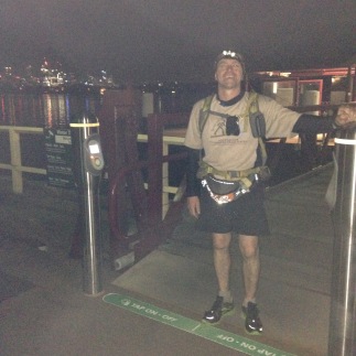 pulled in and Leah got a photo of me. She was willing to drive me to Circular Quay there and then but I declined her kind offer. As far as I was concerned I had made it from Queens Warf on Newcastle Harbour to Woolwich Warf on Sydney Harbour taking 91hrs. A ferry trip or drive to Circular Quay just to stand by an obelisk meant nothing to me.
“Let’s just go back to Janet and Bazza’s. I said. “Tomorrow, you, Aubrey and I can drive down here and catch the ferry together to Circular Quay”.
So we did just that.
Gear and Consumables
Pack: Macpac Amp Race 25ltr. A bit old and worn. Light with plenty of room and external storage. Styrofoam back plate insulates water bladder and handy for sleeping pad if you’ve got nothing else!
Shelter: Auscam Hoochie 1.85m x 2.85m. 520grams and well worth its weight.
Phone: Aspera R5. Chunky but waterproof and tough. Fast satellite locating for GPS tracking app. Also carried 2 battery banks to top up battery.
GPS Tracker: Followmee tracking app for mobile phone. Worked very well. Link to my GNW260: https://www.google.com/maps/d/edit?mid=zP8EcvswJYaA.kln_O-wRuTPo&usp=sharing
Lights: Ay Up LED run kit with 3 batteries and very handy waist pack. Cannot fault these lights. Absolutely no trouble seeing at night.
Shoes: Reebok Zigtech. Hard to get sore feet in these things. Grip like geckoes too.
Socks: Kathmandu merino trail socks x 3 pair. I love these socks. Should have carried more!
Underwear: Jockey Sport Trunks x 3
Running Clothes: Footy shorts, GNW100 2014 competitor’s shirt, long sleeve thermal top, fleece.
Sleeping Clothes: Long thermal pants, long thermal top, merino fleece top, lightweight water proof pants and top, dry socks, beanie.
Headwear: woollen beanie, Cancer Council Kalahari hat
Contingency Gear: Lightweight balaclava, gloves, space blanket, medical kit, fire starters, Swiss Army knife, spare LED headlamp and spare batteries, compass, full GNW map set, para-chord
Supplements: S-caps electrolyte capsules, 2 x caffeine gels, glucose tablets, Panadol, Ketoprofen, pawpaw ointment, hand cream.
Crap I ate: 2 cheese breads, 8 muesli & 2 snickers bars, soy & potato crisps, fruit cake, 3 hamburgers with chips, battered sausage and spring roll, 2 tubes of custard for infants, apple, banana, snakes

A fantastic read! I could never attempt such a quick journey so I find myself amazed at those who can. Well done and I hope that in the two years since you did this it has all finally stopped hurting 🙂
LikeLiked by 1 person
The pain is long gone while the memory lasts forever. One of the most fulfilling things I’ve ever done!
Be it done in 50hrs or over 5 yrs, the GNW is a life changer. Whenever I see a full moon, or the silhouette of the Watagans or Wandabyne from the M1, or pass under the Jerusalem Bay track bridge, I get a calling. You know what I mean? Yeah, you are a fellow traveller, you know what I mean. 🙂
LikeLike